Hazards
Comprehensive guides to every natural hazard that affects Nevis — what it is, where it occurs, what to do before, during and after.
Hurricane
Tropical-cyclone season, watch-warn timeline, shelter triggers, household kit.
OpenEarthquake
Tectonic context, drop-cover-hold drill, what to do after a tremor.
OpenTsunami
Caribbean tsunami sources, evacuation routes and Tsunami Ready programme.
OpenVolcano
Hazard map, ashfall guidance and Mount Liamuiga monitoring.
OpenFlood
Flash-flood drivers, low-lying zones and household-level mitigation.
OpenStorm Surge
Coastal-surge geography and the storm-surge atlas.
OpenLandslide
Slope failure indicators, monitoring sites and household action.
OpenDrought
Water conservation, agricultural impact, multi-year drought patterns.
OpenHeat Wave
Heat illness, who's at risk and household cooling guidance.
OpenFire
Bush-fire season, home-defence space and the fire-service contact tree.
OpenCoastal Erosion
Long-term shoreline retreat, monitoring sites and adaptation options.
OpenSea Level Rise
Projected scenarios, infrastructure exposure and resilient design guidance.
OpenSKN Hazards Risk Profile
Country-level risk profile for St. Kitts & Nevis.
OpenClimate Change Risk Profile
Climate-change risk profile for SKN.
OpenDisasters
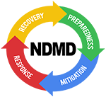
What constitutes a disaster — definitions, phases and the response cycle.
OpenNeed to speak with NDMD?
The 24/7 hotline is 469-1423. For broader contact options, partnerships and visits — head to our contact page.