Robert L. Bradshaw International Airport
St. Kitts Meteorological Services
St. Christopher Air & Sea Port Authority
P.O. Box 963
Basseterre
St. Kitts
Tel: 869 465 2749 Tele- fax: 869 465 9122
Urgent – Marine Weather Message: High Surf Advisory
Antigua and Barbuda Meteorological Services
7:00 AM Tuesday 17th Sep 2019
A high surf advisory goes into effect today for mainly the Northern and Eastern shorelines of Antigua, Barbuda, Anguilla, the British Virgin Islands and St. Kitts and Nevis.
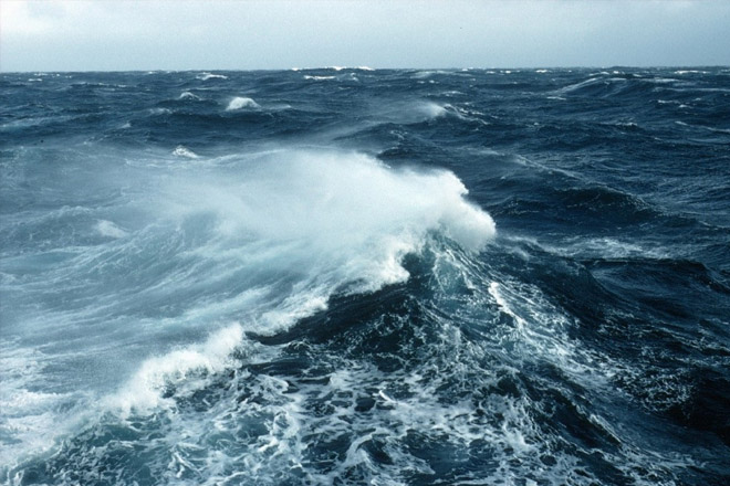
A low-pressure area over the far North Atlantic is pushing long northerly swells of moderate height toward the islands. These swells will cause dangerous breaking waves (surfs) and life-threatening rip currents.
Seas: 1.5 to 2.5 metres (5 to 8 feet), occasionally reaching 3 metres (10 feet). Swell period: 12 to 14 seconds. Swells: northerly at 1.2 to 2 metres (4 to 7 feet) and occasionally higher.
Surfs (breaking swells): Over 2 metres (over 6 feet). These conditions will be conducive for dangerous rip currents. Please note that surfs could be as much as twice the height of swells, depending on the bathymetry of the near shore areas.
Coastal flooding: High tides combine with onshore wind and swell actions could result in localized coastal flooding and beach erosion.
Locations (to be) affected: Reefs and exposed northern and eastern facing coastlines with relatively shallow, gently sloping near shore areas.
Impacts (possible/likely/expected): Loss of life – strong currents that can carry even the strongest swimmers out to sea; injuries to beachgoers; beach erosion; sea water splashing onto low lying coastal roads; beach closures; localized disruptions to marine recreation and businesses; financial losses; damage to coral reefs; salt water intrusion and disruptions to potable water from desalination. High surfs can knock spectators off exposed rocks and jetties. Breaking waves may occasionally impact harbours making navigating the harbour channel dangerous.
Precautionary/preparedness actions: A high surf advisory means that dangerous surfs of 2 to 3 metres or 6 to 10 feet will affect coastlines in the advisory area, producing hazardous conditions. Beachgoers should be extremely cautious; bathe only where lifeguards are present or the sheltered, less affected southern beaches.
Rip currents are powerful channels of water flowing quickly away from shore, which occur most often at low spots or breaks in the sandbar and near structures such as groins, jetties and piers.
If caught in a rip current, relax and float. Don’t swim against the current. If able, swim in a direction following the shoreline. If unable to escape, face the shore and call or wave for help.
Stay tuned for further updates.
Leave a Reply