NEVIS DISASTER MANAGEMENT DEPARTMENT (NDMD)

Home

Watches & Warnings

WHCA31 TAPA
HURRICANE ERIN ALERT STATEMENT 6
ANTIGUA AND BARBUDA METEOROLOGICAL SERVICES
5 PM ECT FRI, AUG 15, 2025

THIS IS FOR THE LEEWARD ISLANDS AND BRITISH VIRGIN ISLANDS

A TROPICAL CYCLONE ALERT REMAINS IN EFFECT FOR ANTIGUA, MONTSERRAT, ST. KITTS, NEVIS AND THE BRITISH VIRGIN ISLANDS. A TROPICAL CYCLONE ALERT MEANS IN THIS CASE, THAT HURRICANE ERIN IS WITHIN OUR MOINITORED AREA BUT NOT CLOSE ENOUGH FOR A WATCH OR WARNING TO BE ISSUED.

THE BEST FORECAST REMAINS FOR THE CENTRE OF ERIN TO PASS NORTHEAST THEN NORTH OF ALL THE ISLANDS. THE CHANCE OF STORM-FORCE WINDS REACHING THE MENTIONED ISLANDS IS LOW. HOWEVER, ANY SHIFT TOWARDS THE ISLANDS COULD BRING THE CORE OF THE SYSTEM UNCOMFORTABLY CLOSE TO THE ISLANDS LATE TONIGHT INTO SUNDAY. THE RISK FROM SWELLS WILL RISE; HENCE, THOSE NEAR COASTAL AREAS SHOULD BE AWARE. OTHER HAZARDS SUCH AS HEAVY RAINFALL ACCOMPANIED BY STRONG GUSTY WINDS ARE ALSO POSSIBLE WITHIIN OUTER RAIN-BANDS.

INTERESTS IN THE MENTIONED ISLANDS SHOULD MONITOR THE PROGRESS OF THIS CYCLONE AND, TO BE SAFE, BE PREPARED FOR THE REST OF THE HURRICANE SEASON.

AT 5:00 PM AST (2100 UTC), THE CENTER OF HURRICANE ERIN WAS LOCATED NEAR LATITUDE 18.9 NORTH, LONGITUDE 57.6 WEST OR 365 MI EAST OF THE NORTHERN LEEWARD ISLANDS, 445 EAST OF THE BVI AND 352 MI EAST-NORTHEAST OF ST.KITTS.

ERIN IS MOVING TOWARD THE WEST-NORTHWEST NEAR 17 MPH. THIS MOTION IS EXPECTED TO CONTINUE INTO THE WEEKEND WITH SOME DECREASE IN FORWARD SPEED. ON THE CURRENT FORECAST TRACK, THE CENTER OF ERIN IS LIKELY TO PASS JUST NORTH OF THE NORTHERN LEEWARDS AND BVI DURING THE WEEKEND.

MAXIMUM SUSTAINED WINDS ARE NEAR 75 MPH WITH HIGHER GUSTS. STEADY TO RAPID STRENGTHENING IS EXPECTED DURING THE NEXT FEW DAYS AND ERIN IS FORECAST TO BECOME A MAJOR HURRICANE DURING THIS WEEKEND.

HURRICANE-FORCE WINDS EXTEND OUTWARD UP TO 25 MILES (35 KM) FROM THE CENTER AND TROPICAL-STORMFORCE WINDS EXTEND OUTWARD UP TO 115 MILES (185 KM) MAINLY TO THE NORTH OF THE CENTER.

THE MINIMUM CENTRAL PRESSURE IS 993 MB 29.33 INCHES.

SWELLS FROM ERIN WOULD CAUSE MARINE CONDITION TO DETERIORATE AND MARINERS ARE ADVISED TO REMAIN IN PORT AND ENSURE THAT YOUR VESSELS ARE SAFELY MOORED.

RAINFALL AMOUNTS OF 2-4 INCHES ARE POSSIBLE WHICH COULD CAUSE FLOODING IN LOW LYING AND FLOOD PRONE AREAS; HENCE RESIDENTS SHOULD MOVE TO A SAFER LOCATION.

FORECASTER
BERNELL

Weather: Friday 15th August 2025

weather-rain

Temperature: 28°C / 83°F
Humidity: 79%
Sea Level Pressure: 1014.8mbs or 29.96”
Winds: Northerly at 12 to 23 mph; however, a westerly shift is expected by tonight with possible gust of 35 mph or higher mainly over open water.
Seas: 1.2 to 2.1 metres or 4 to 7 feet. A high surf advisory will go into effect by tonight.
Sunset: Today 6:36 pm
Sunrise: Tomorrow 5:54 am
Weather Forecast for St. Kitts & Nevis (7 am): As, Tropical Storm Erin moves closer to the area, the chances of showers will increase along with a possibility of thunderstorms. Possible rainfall accumulation for the forecast period up to 50.8 mm or 2 inches…Full Details

Climate Center

Atlantic Season Hurricane Outlook: June – November 2025

There’s a potentially intense but erratic hurricane season ahead for the Atlantic region this year! Find out how many named storms, hurricanes and major hurricanes are forecasted.  Get a full insight.

CariCOF Caribbean Climate Outlooks: August to October 2025

Excerpt: The forecast ENSO neutral conditions, near-average sea surface temperatures in the Tropical North Atlantic and persistent warmth north of the Caribbean imply: (i) recurrent excessive humid heat…read more

CDPMN Caribbean Drought Bulletin – August 2025

Though many countries in the region experienced below normal rainfall in June, the rains will continue to increase across the region with not many areas of concern over short and long term droughts. It…read more

Caribbean Tourism Climatic Bulletin: June – August 2025

Climate risk management linked to enhancing visitor health and safety, remains a critical factor in ensuring tourism sector resilience…read more

CCRIF SPC’s Annual Report 2023-24 is now available

The CCRIF Annual Report 2023-24 covers the reporting period June 1, 2023 to May 31, 2024 and provides a snapshot of CCRIF’s activities and accomplishments. 2023-24 represents 17 years since CCRIF began operations, providing access to quick liquidity following natural disasters. Today CCRIF offers 6 parametric insurance products and continues to work to bring to market additional innovative parametric insurance products for new perils and economic sectors… advancing resilient and sustainable development in the regions we serve.

For our members in the Caribbean and Central America, CCRIF is:

  • Closing the protection gap
  • Building resilience
  • A strategy for loss and damage due to climate change

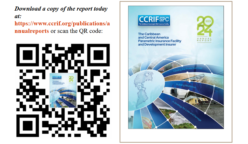
The 2023-24 annual report includes key achievements, audited financial statements, and progress under each of our seven strategic objectives. Check it now.