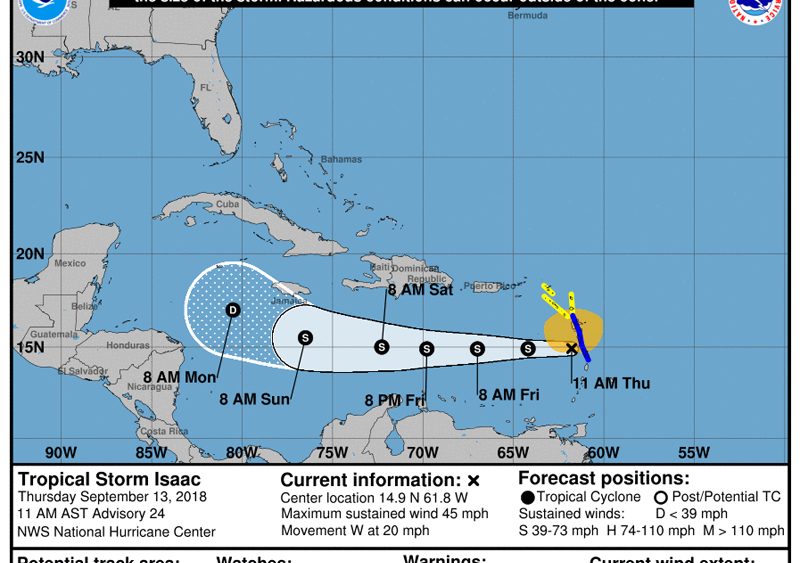
TS Isaac at 11 am position 14.9N 61.8W moving forward at 17 mph. MAX sustained winds were 45mph. TS Isaac has moved/shifted further South and West. Based on the current track it is anticipated to pass Nevis at its closest point 152 miles or greater to the South.
The strongest winds may be experienced between 2pm and 3pm. The radar images show rain bands approaching the islands thereafter. Weather conditions may deteriorate as the afternoon progresses. Be on the alert and stay safe.
Please continue to monitor the progress of TS Isaac and listen to the Notices on VON Radio.
Director
NDMD


